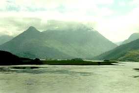
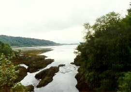
View up Loch Leven towards Glencoe
from the Ballachulish Bridge (left); enroute
to the four Peninsulas on the Corran Ferry
(right), which crosses Loch Linnhe at the Corran Narrows from
Kappanach to Ardgour on the Sunart Peninsula - and to a jetty
built (1815) by Thomas Telford
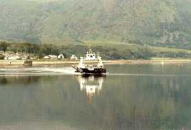
View of farm life along the northwestern
shore of Loch Linnhe, on the coast of the Sunart (left); near
the mouth of Loch a' Choire, which defines the northeastern border
of the Morvern Peninsula - a salmon farm occupies the center of
the Loch (right)
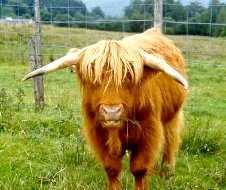
West into the interior of the Morvern,
a Highland bull playing "Ferdinand," complete with stalk
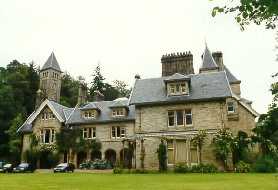
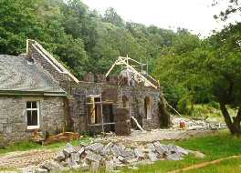
of grass in his mouth (left); Ardtornish
House (completed in 1892), at the head of Loch Aline in the southwest
corner of the Morvern (right)
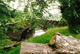
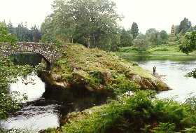
The mouth of the Rannoch River (left),
near the head of Loch Aline; a stone bridge just upstream (right)
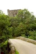
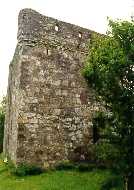
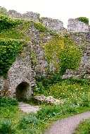
Across the bridge, the isolated square
keep of the 15th c. Kinlochaline Castle - originally Caisteal
an Ime (Butter Castle), according to legend from the "coin"
in which its masons were paid - nearly hidden from view on a low
bluff above the river (left). This 4-story rectangular keep (center),
with 10-ft thick walls of Lias limestone, was the seat of the
MacInnes Clan, but after the murder of the MacInnes laird and
his 5 sons by Donald, Lord of the Isles, at Ardtornish Castle
in 1390, it was given to the MacLeans of Duart; it was abandoned
and burned by MacColla in 1644 during a seige by the Campbells.
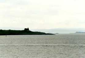
View southwest past the silhouette of Ardtornish Castle (14th
c.), at the mouth of Loch Aline on a headland (Ardtornish Point)
jutting into the Sound of Mull, with the island on the far horizon
(right)
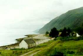
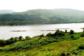
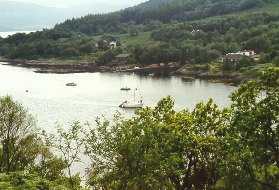
View from the northern bluffs of the
Morvern across Loch Sunart, complete with ubiquitous salmon farms
(left); back on Sunart, low tide in the village of Strontian (on
the river of the same name) near the head of the Loch, site of
an early 18th c. lead mine in which the mineral strontianite,
source of the element strontium, was found in 1764 (right)
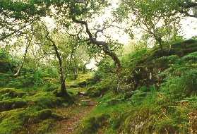
The Salen Oakwoods (Coilltean Darach
an t-Sailein), a remnant of the ancient Caledonian forest which
originally covered western Scotland, spared because of its remote
location in the southeast corner of the Ardnamurchan Peninsula,
and its site on the steep slopes of the bluff along the Loch (left);
north across the Ardnamurchan to the village of Acharacle, and
a view near the mouth of Loch Shiel (right), which forms the southern
and eastern boundaries of the Moidart Peninsula
Fly fishing (with a two-handed Spey
rod) for salmon on one of Shiel's tributaries, the private waters
of the Loch Sheil Estates (left); housing boom along the remote
shores of Loch Moidart (right)
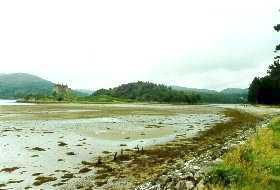
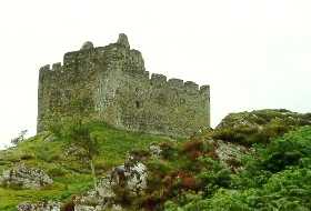
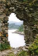
Views of Castle Tioram ('Chee-rum'),
which lies on a rocky islet in the middle of Loch Moidart: the
castle is accessible at low tide across a narrow spit of treacherous
sand that barely emerges above water (left). The castle dates
from the 13th c.; it became the seat of the Clanranald branch
of the MacDonalds when it passed into the hands of Ranald, son
of John, first Lord of the Isles, in 1371; the structure consists
of a curtain wall 30 ft high and 8 ft thick which encloses buildings
from the 14th, 16th, and 17th c. (right)
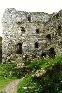
The 3-story keep on the south side
(left); the castle was besieged several times, e.g., by Cromwell
in the mid-1600's, but was never taken; it was finally destroyed
in 1715 when the Chief of Clanranald ordered it burned to prevent
its capture during the Jacobite Uprising